Another One

The drive up California’s coastal Highway 1 from Los Angeles to San Francisco is a well-beaten and well-documented path, bordering on cliche at this point. However it was still a trip that I felt compelled to do and was pleasantly surprised at the relatively undisturbed stretch of road I found.
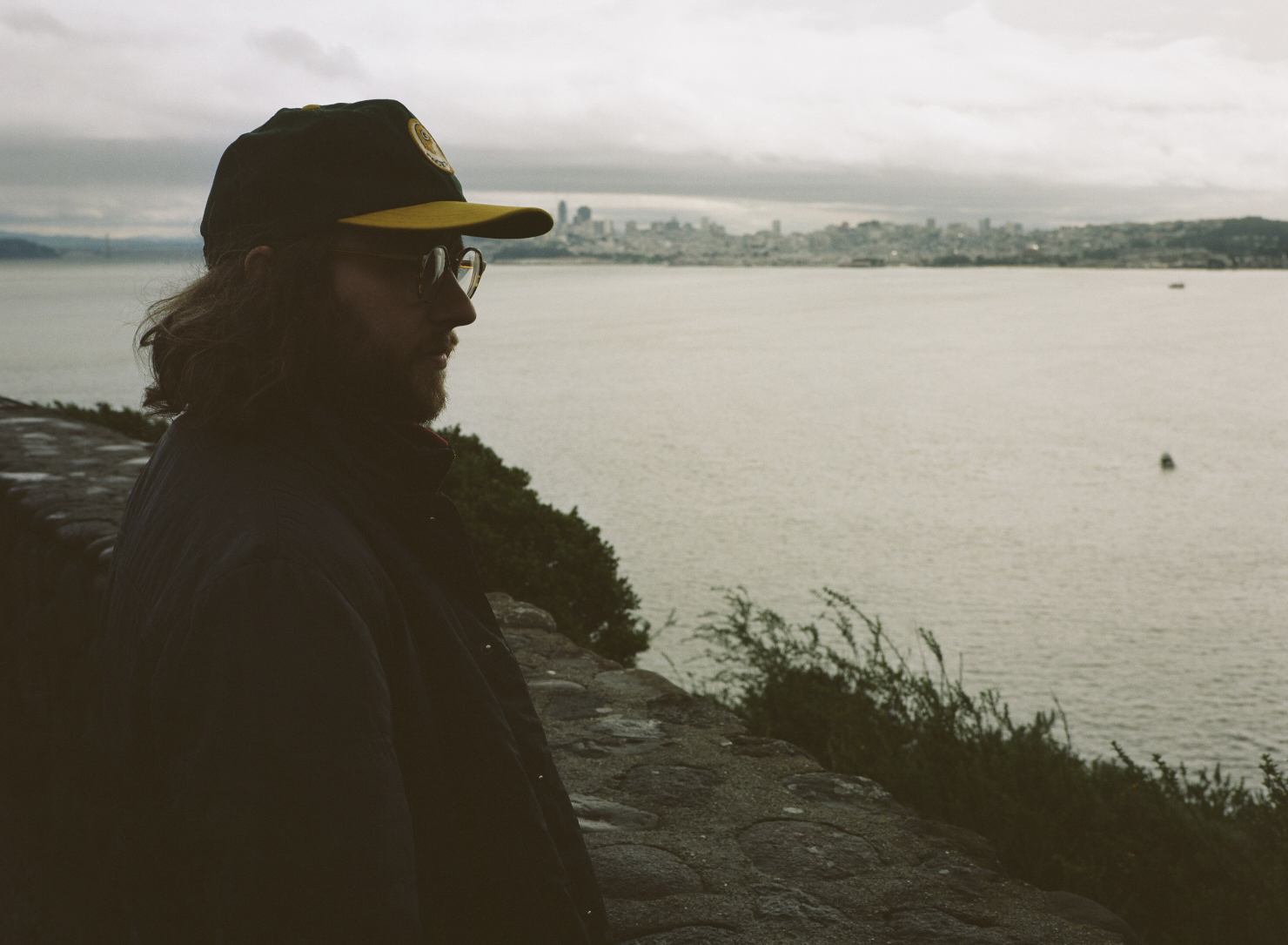
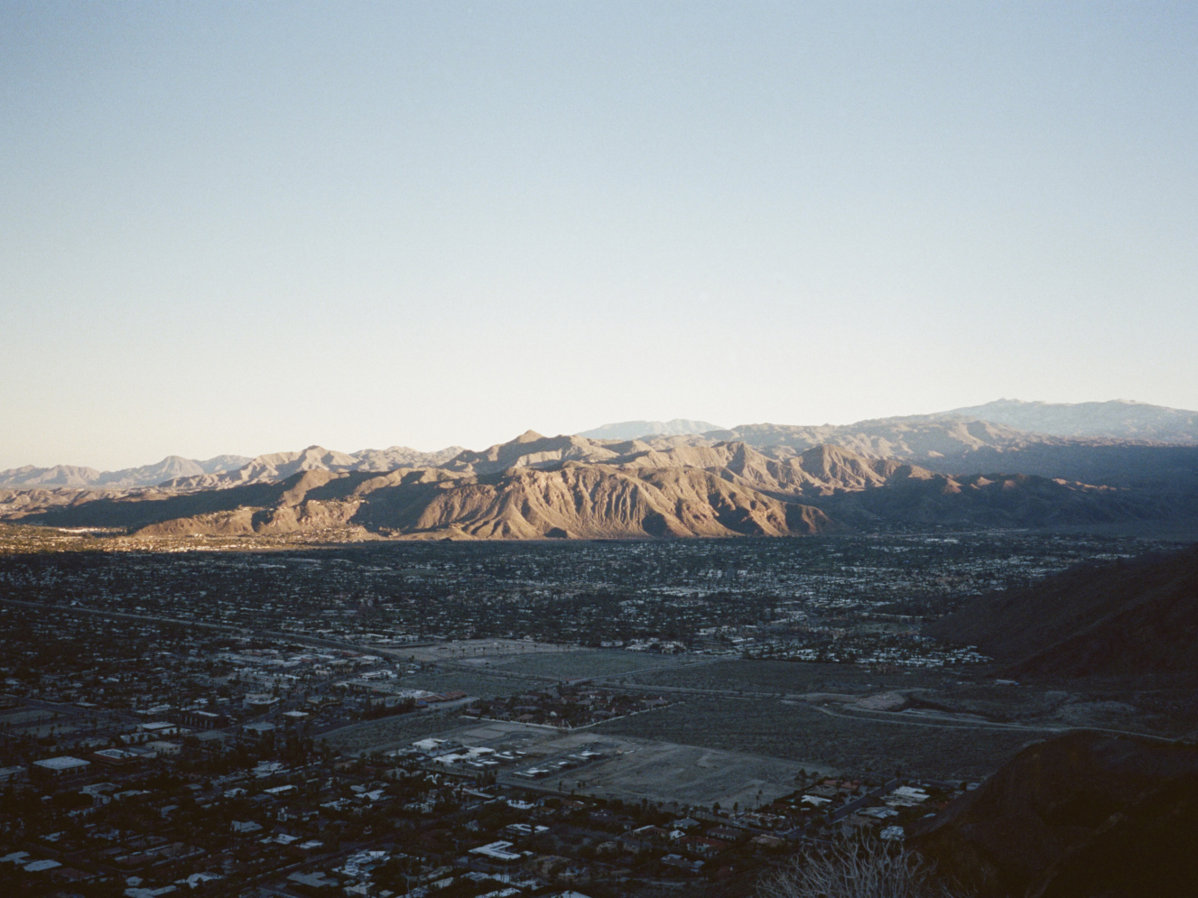
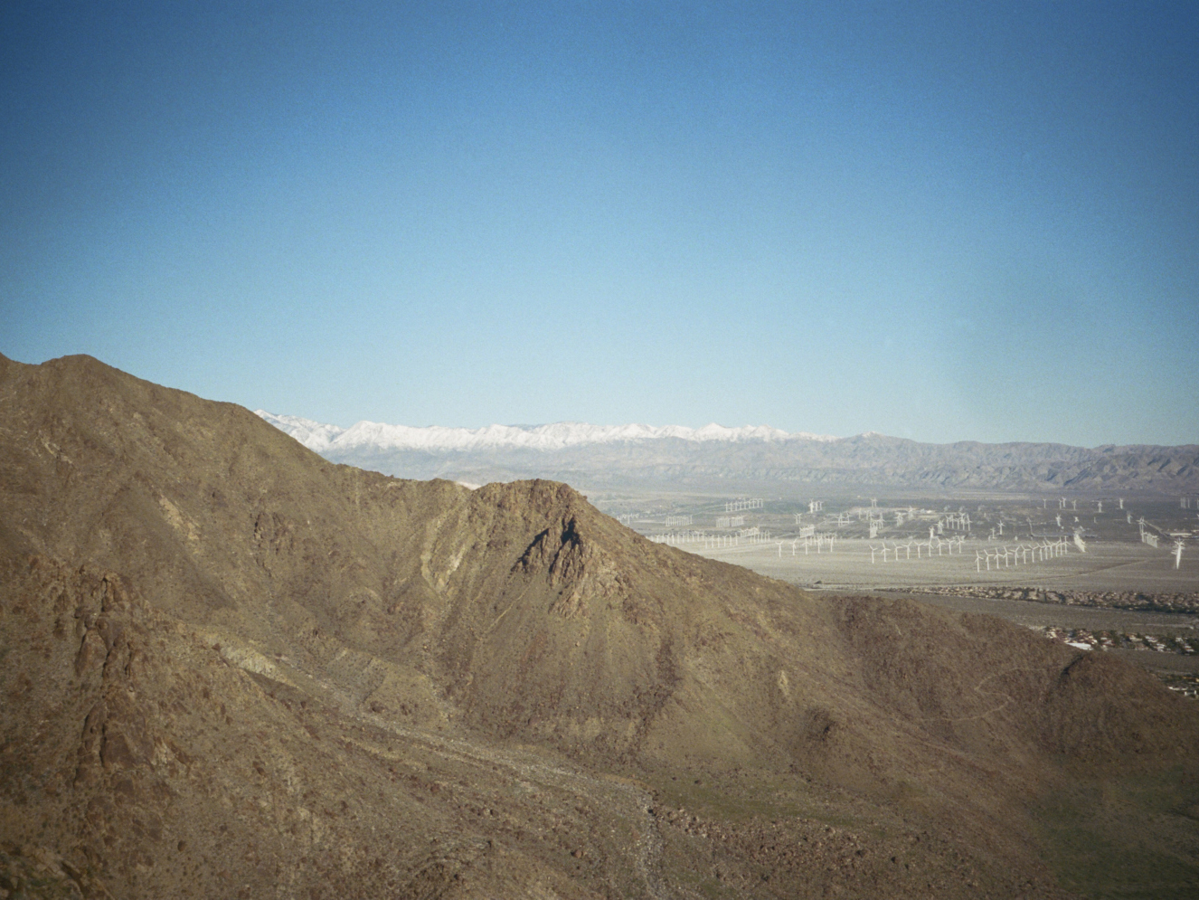
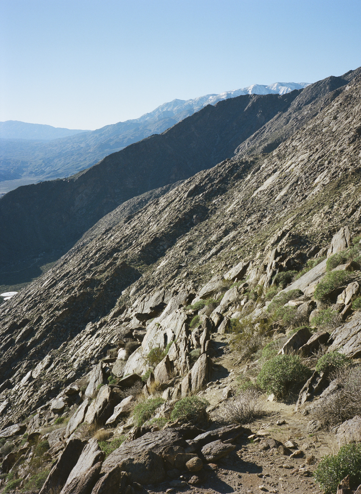
The trip to the Promised Land started with an excursion into the desert oasis of Palm Springs. I had time only for a brief jaunt up into the hills overlooking the expansive desert before beating it back up to Los Angeles for a few days in paradise. My first glimpse of the Pacific was in Malibu on a sunny Sunday afternoon hike up Sandstone Peak to the highest point in the Santa Monica Mountains. The following day my copilot for the rest of the trip, Matt Riley, flew into LAX and we spent the evening rambling around Silver Lake’s finer drinking establishments. Before daybreak the following morning we packed into our rental car and were off.
North of Malibu was uncharted territory for me. As the day broke we made our first pit stop off the 1 and took in the morning sunlight reflecting off the Pacific. From there we balled it along the open road up to picturesque Santa Barbara for gas and provisions.
As we checked our way on our gps we were baffled by the routes it suggested. For some reason we couldn’t get the app to take us all the way to Frisco via the coastal PCH; it kept rerouting inland even when it looked on the map like it should go right through. We paid it no mind, too distracted by the glory of another beautiful California day. However before too long the situation became clear: heavy winter rains that year had caused landslides blocking the stretch of road south of Big Sur. This meant at least a two hour delay to get to the area that was only an hour or less directly on the PCH.


"As we begrudgingly turned back to take an inland road, our dismay turned into a pleasant surprise."
As we begrudgingly turned back to take an inland road, our dismay turned into a pleasant surprise. The views from the small highway winding into the highlands above the coast were spectacular, and we stopped to shoot some photos of the landscape below. After an hour north on a relatively boring road, we had a new adventure. The gps took us on some strange, curvy backroads through what appeared to be a semi-defunct military base. This bizarre sight eventually gave way to Los Padres National Forest.


As we began to climb through lush forests on an increasingly narrow and windy mountain road, our exhilaration with the trip followed suit; by dumb luck we had found the prettiest possible way to enter the Big Sur area. From the crest of this little mountain road we could see out over the entire region, the coast on one side and the rolling hills of the interior on the other. The sun was starting to get low as we came back down onto the coastal highway and we were unsure if more landslides would prevent us from getting to our planned campsite.
“Planned Campsite” is a bit of an overstatement. Matt had heard about it from a friend, not an official site, and merely a dropped pin shared on his phone. As we revved the little rental car up the steep dirt road, the lack of signs or other people made it difficult to decide whether this would work or not. Fortunately, the top of the hill had what appeared to be a promising foot trail leading from a clear spot to park the car on a widened patch of gravel road. With the light fading, we bounded up the trail to find the most ideal tent site on the side of a hilltop overlooking a magnificent stretch of coast.


"...amongst high grasses and brambles I felt completely vindicated in the lengths I’d gone to in order to make this trip happen."
After hastily setting up camp, we headed back to a vista point we’d passed on the road to witness the sunset and photograph its final glow sweeping across the pristine coastline laid before us. The sunset was deep and red, and amongst high grasses and brambles I felt completely vindicated in the lengths I’d gone to in order to make this trip happen. Matt and I headed back to our humble camp and proceeded to cook a typical camp dinner before taking in the vast night sky above that hallowed hilltop.

The sunrise, while not as clear and piercing as sunset, had it’s own glory. As it slowly illuminated the landscape while remaining hidden by the hills beyond, we sipped our strong coffee and again marveled at the luck we’d had in making it to such a place. The morning was clear as we drove back down to the coast and proceeded north.
That morning we skirted around several more landslides, the road in varying stages of disrepair. Our uncertainty remained high, but the previous day’s adventures kept us optimistic. As we wound into Big Sur proper my awe of the landscape reached new proportions. Despite mass closings of state land due to fires the previous fall and winter rains, one trail in Julia Pfeiffer State Park had just reopened.

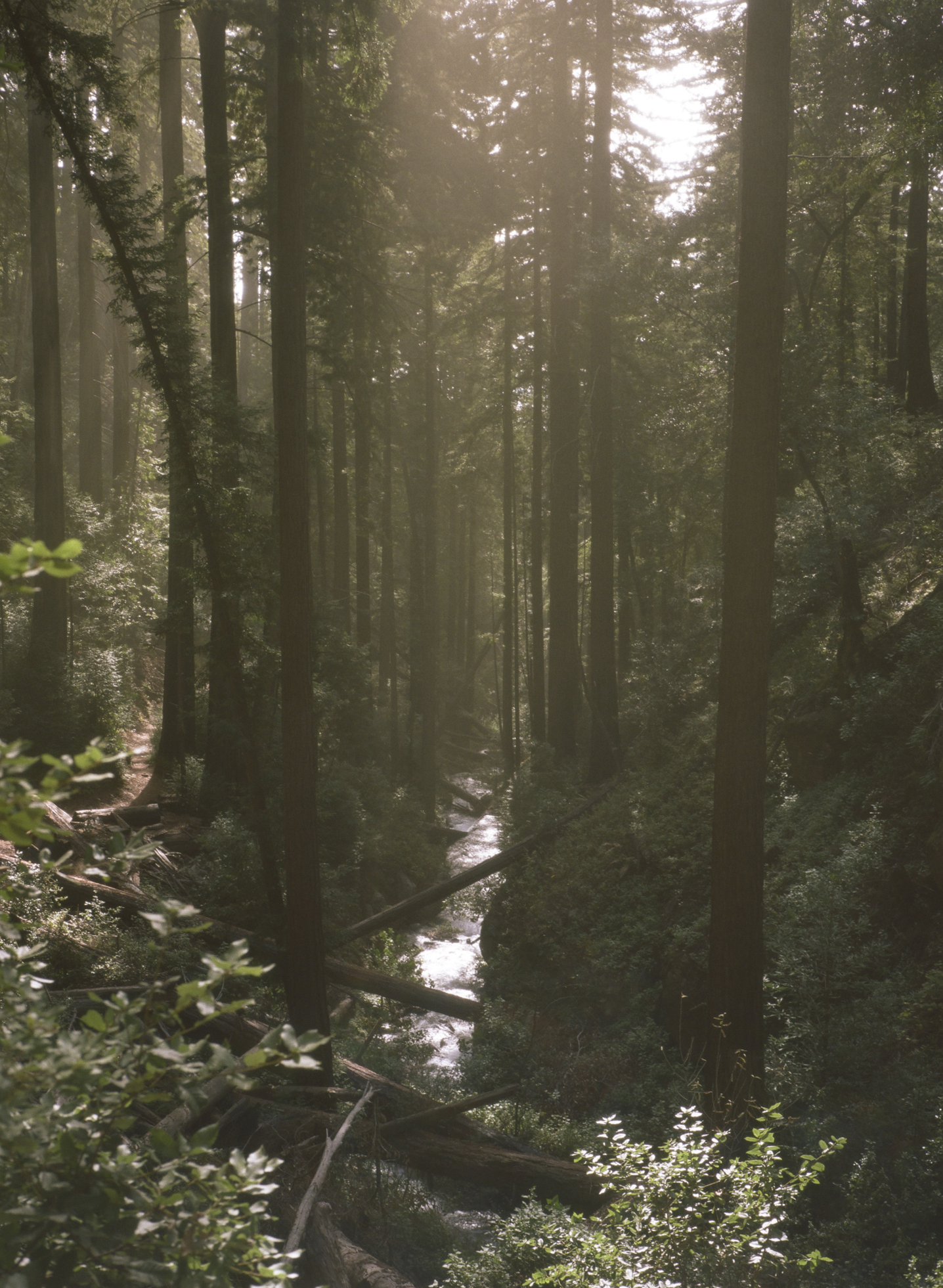
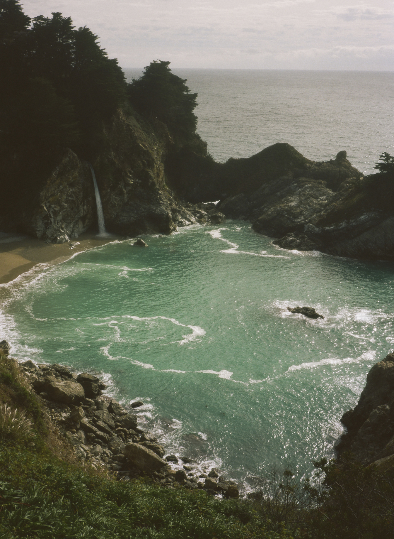
Hiking up through the redwoods, I again redoubled my amazement with California as the one and true promised land. Tramping through streams flowing through the fresh undergrowth, we soon reached a ridgeline that took us above the treetops and allowed clear views of the forest below reaching to the cliffs of the coast. The sun shone clear into impossibly blue patches in the the ocean that seemed calm from that elevation. We met few along the trail even though it was another perfect day. After making quick work of the longest trail available to us, we dined at the equally remarkable Nepenthes restaurant situated on a cliff overlooking the coast.